Drone Photography Nottingham
With over a decade of experience in the UAV drone photography sector, we offer tailored solutions to meet your needs, whether it’s still imagery, videography, FPV or more specialised applications. Before any work begins, we conduct thorough pre-flight checks, coordinate with relevant air traffic control where necessary and provide comprehensive documentation including risk assessments, insurance details and issued CAA authorisation certificates.
Why hire a professional drone photographer?
At Screen Photography, we believe that the best stories are told from every angle. While traditional ground level photography captures the details, drone photography technology allows us to capture scale. Whether you are planning a dream wedding, marketing a commercial property or managing a complex construction site, our CAA authorised operators bring a unique, sky high perspective that transforms how you see your project.
Weddings: Cinematic Memories
Your wedding day is a tapestry of moments and some are simply too big for a handheld camera. Drone photography adds a cinematic layer to your wedding album that ground shots simply can’t match. We can capture the grandeur of your venue, the sweeping landscapes of the countryside and that spectacular group shot of all your guests waving from below. It’s not just about taking photos; it’s about capturing the atmosphere of your big day, providing you with 4K video and high-resolution stills that make your wedding film feel like a movie.
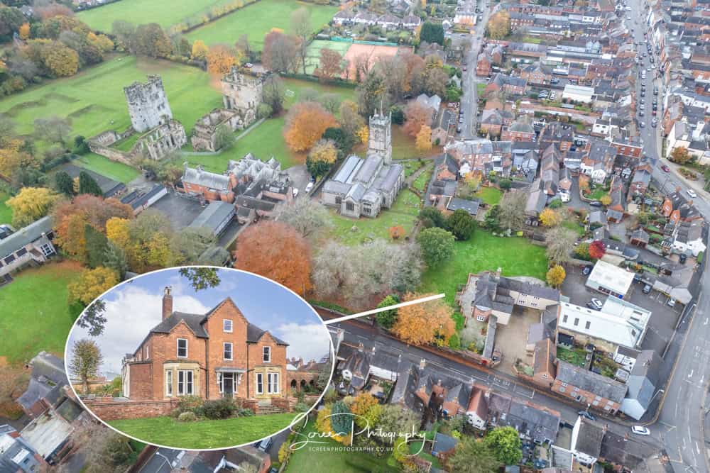
Commercial Property: Marketing that Sells
In the competitive world of commercial real estate, context is everything. Potential investors and tenants need to see more than just the front door, they need to understand the location and surroundings. Our drone services provide a bird’s eye view that highlights proximity to transport links, local amenities and the sheer scale of the site. High-quality aerial imagery grabs attention instantly, increasing engagement on listings and helping you close deals faster by giving clients the full picture before they even step on-site.
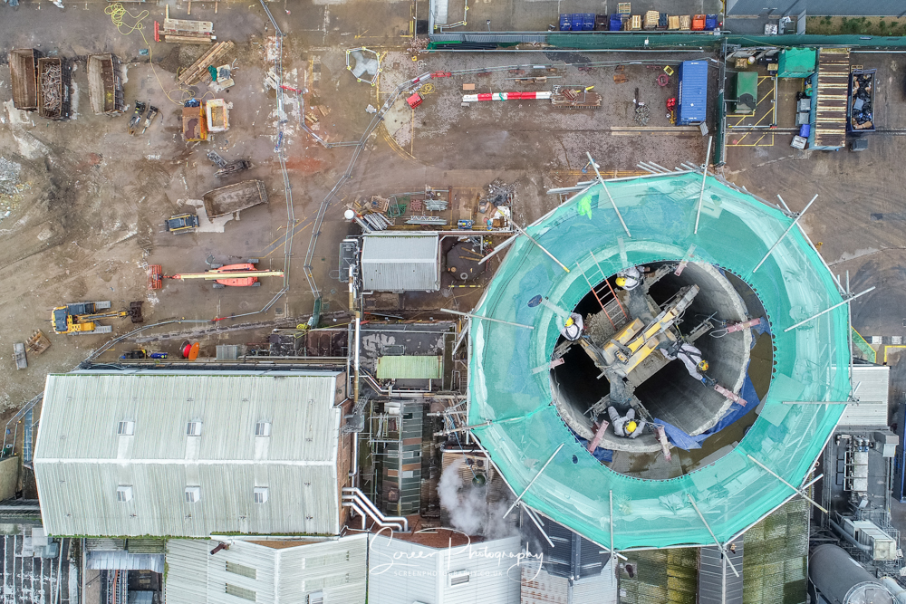
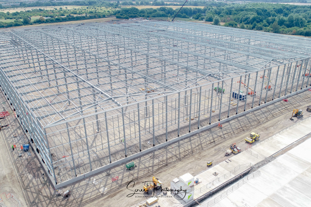
Construction: Efficiency & Safety
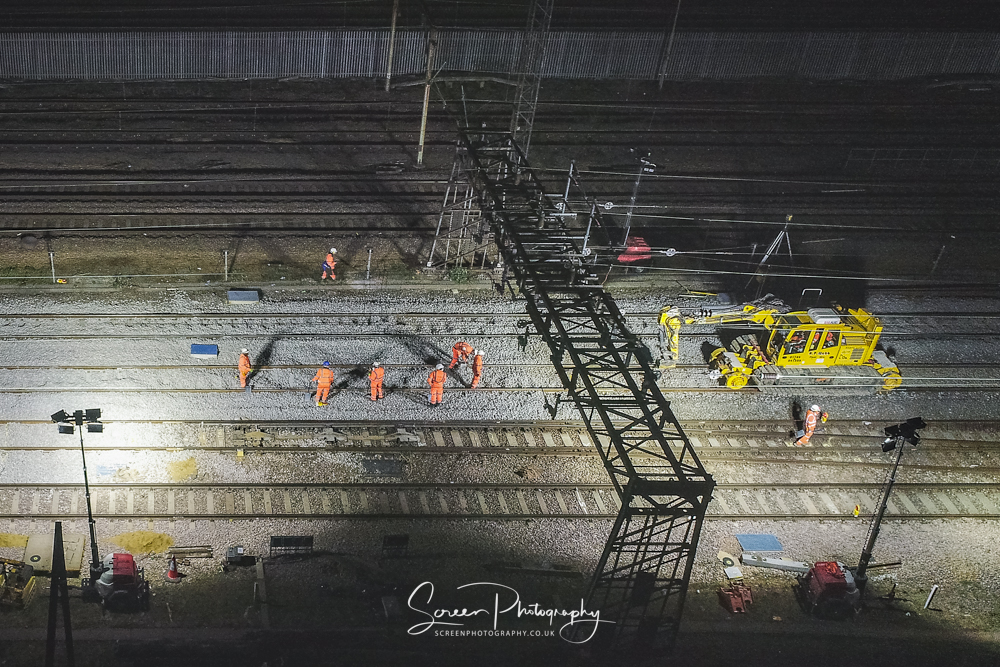
For the construction industry, our drones are a vital tool for safety and progress monitoring. We offer a cost effective alternative to scaffolding and cherry pickers for site surveys and roof inspections, keeping your team safely on the ground while we assess hard to reach areas in high definition. From land boundaries for planning applications to time-lapse footage of a building progress for stakeholders, our aerial data helps you make smarter, faster decisions without disrupting the workflow.
At Screen Photography, we combine creative vision with technical safety to deliver drone photography footage that goes above and beyond.
What OUR drone’s can assist with
Commercially, drones can fly over a vast array of objects and environments to capture data, but the legality often depends heavily on where you are flying and what class of drone you are using (e.g., CAA in the UK).
- Roofs: Inspecting residential or commercial roofs for storm damage, leaks, debris or insurance claims.
- Wind Turbines: Flying up the blades and nacelle to check for lightning damage or delamination.
- Cell Towers & Radio Masts: Inspecting 4G/5G antennas, cabling and structural bolts.
- Power Lines & Pylons: Checking insulators and sagging lines.
- Bridges & Viaducts: inspecting support pillars for concrete spalling or rust.
- Stockpiles: Flying over piles of gravel, sand or earth to volumetrically measure how much material is there.
- High-rise Facades: Checking sides of cladding issues or window seal failures.
- Golf Courses: Videoing fairways and greens for promotional marketing.
- Landfills: checking fill levels and compaction rates.